Author: Dr. Rodrigo M. Sicat
Web Design: Engr. Mark Jason V. SicatANAO: SERENE TOWN OF ILANG-ILANG BLOSSOMS
Early settlers of the town came from the Ilocano-speaking population of Camiling whose ancestral stocks were from Paoay, Ilocos Norte. Originally, Anao was one of the barrios of Paniqui when the latter was still a town of Pangasinan. It was established as a town on March 1, 1870, earlier than its neighboring towns of Moncada, San Manuel, and Ramos. Don Fruto Pastor, one of its early settlers, founded Anao. He became the Capitan Municipal in the same year. Don Antonio succeeded him in 1872.
Since then, the political structure of the town has evolved as it is today.
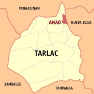
Anao is the smallest municipality in the province. It is located in the northeastern part of Tarlac; it is bounded on the north by San Manuel, in the east by Nampicuan (Nueva Ecija), on the south by Ramos and on the west by Paniqui and Moncada.
A predominantly Ilocano-speaking village, Anao has a population of 10,045 people in 2,086 households (NSO, 2000).
Basically, the town is an agricultural village that produces rice, corn, vegetable, and sugarcane crops.
Anao is a serene village known for ilang-ilang (Cananga odorata (Lamk.) Hook.) production. Ilang-ilang blossoms produce oil extract that is used for making perfumes. The demand for ilang-ilang production is great, both here and abroad, which is why it has contributed to the economy of the town.
BAMBAN: GATEWAY TO TARLAC
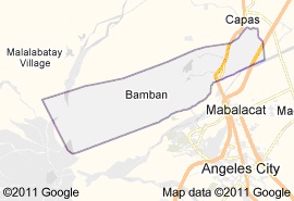
Bamban is located at the southernmost part of Tarlac Province. On the north, it is bounded by the municipality of Capas, Tarlac, and on the south, by the municipality of Mabalacat, Pampanga. The Parua River, popularly known as Bamban River, separates Bamban from Mabalacat. Toward the east lies the municipality of Concepcion, Tarlac. On the western side, the terrain is rugged due to rolling hills and mountains bordering the municipality of Botolan, Zambales. The wide tract of flat lands on the eastern side is suited to agriculture. This is where many of Bamban’s are engaged in farming.
Historical records states that the early inhabitants of the settlement, which was to become Pueblo de Bamban, were the Aetas or Negritos and Zambals. Later, other settlers came from Pampanga and other neighboring provinces. Those settlers found the place with plants of mabamboa or bambania growing abundantly along the riverbanks. The place was called cabambanan or mabamban but later on it was simply called bamban.
At present, the Kapampangans composed approximately 90% of Bamban’s population. The remaining 10% composed of Ilocanos, Tagalogs, Pangasinenses and Zambals. Roman Catholicism is the dominant religion which is about 85% while the rest are Iglesia ni Cristo, Methodists, Baptists and other evangelical groups. The presence of those religious sects attests that its people are religious. Farming is the main occupation of the residents who live at the eastern part of the town. Among the professionals, the teachers are the greatest in number, drivers of passenger jeepneys and tricycles ranked second. The rest offers personal services such as the carpenters, barbers, beautician, masons and other construction workers.
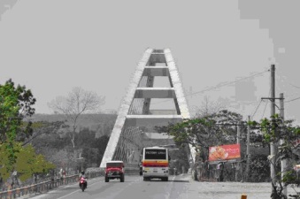
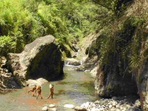
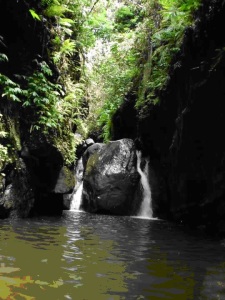
Bamban is endowed by the Divine Providence with rolling hills and gorgeous mountains of San Vicente, Sto. Nino and San Nicolas. The Sacobia Lake in barangay Sto Nino was a result of the eruption of Mt. Pinatubo in 1991. Another interesting spot to see is the waterfalls at Sitio Malasa. Some Japanese tunnels still exist on the mountains of barangay San Nicolas. There are also man-made wonders in Bamban that include the Wonderland Resort at barangay Anupul, the grottos of our Lady of Lourdes in barangaysLourdesand sitio Magurul Gurul, and the concrete suspension bridge at the southernmost part of Bamban.
BAMBAN BEFORE WORLD WAR II
Life in Bamban before the outbreak of the war was simple. Majority of the people lived in small houses made of bamboos, nipa or cogon, sawali and other local materials available in the community. There were few big houses owned by wealthy hacinderos and professionals, yet, their number is few. Today, most of these ancestral houses no longer exist, including the house of Don Jesus Feliciano – a wealthy landlord, located few meters from the railroad station at barangay San Nicolas. The old house of Atty. Benjamin Gacioco located across the old sugar central was also dismantled right after the Liberation Period. Another one that no longer exists is the house of Dr. Potricio S. Santos, grandfather of Vilma, a multi –awarded actress turned politician.
During those periods, calesas, calising and carts were the usual type of transportation. Very few had family cars like the Felicianos, Santos and Gosiocos. Other rich families owned calising, which were drawn by horses. Now, Bamban is found with tricycles and passenger jeepneys, instead, of the calesas and calising.
Long before the war, the rural folks in this community practiced bayanihan. Farmers helped one another in preparing their rice fields during planting and harvesting seasons. To make their work easier and faster, the community folks practiced the sugo. But because of the invention of modern machineries such as the threshing machines, tractors, and bulldozers, the practice among the farmers is rarely observed nowadays.
The farmers in Bamban traditionally practiced the lasac dalungdong after a bountiful harvest. This is a way of showing their gratitude to God for the blessing they received at harvest time. Barrio folks come to partake sumptuous food made available for everyone. Today, the lasac dalungdung festivity held in rice fields or farms is gone; instead, parties are held in resorts or restaurants.
Another traditional practice in Bamban is the Santa Cruzan held in May. The tradition is the procession of beautiful maidens and gentlemen during the evening that parade along the streets of the town beginning May 15 until the end of the month. Naturally, the burden of inviting beautiful ladies from the neighboring barrios or towns plus, the preparation of supper would entail much expense on the part of the host; thus, is perhaps the reason why the Santa Cruzan has become scarce this day.
Again before the war, lively music during parties, anniversaries and other special occasions had to be provided by rondalla players. But now, videokes and other electronic musical devices are being used instead. This is one reason why there are few surviving rondalla players these days in Bamban.
THE JAPANESE OCCUPATION
With the coming of the Japanese Imperial Army in Bamban, many of its civilian residents suffered untold hardships and brutalities. The Japanese army occupied the sugar central as their garrison or detention camp. Innocent civilians were brutally tortured on mere suspicion of being members of the guerilla movement.
To propagate Japanese language and culture, schools were opened. The teaching of Nippongo as a subject was compulsory and the children were forced to study it. During this regime, the Kapisanan ng Paglilingkod sa Bagong Pilipinas (Society for Service to the New Philippines), popularly known as KALIBAPI, was utilized by the Japanese invaders to gain the cooperation and goodwill of the civilians. But despite this Japanese propaganda, many cabalens joined the guerrilla USAFFE or Hukbalahap (Hukbong Bayan Laban Sa Hapon). Several resistance units were organized me and one of them was USAFFE guerilla under Capt. Bruce, an American soldier. Squadron #45 of the Hukbalahap movement was under Apung Nasiong Gamboa alias Commander Luna.
THE LIBERATION PERIOD
Perhaps, Bamban was the only town in Central Luzon, which suffered most when the American forces came to liberate the Philippines. The whole poblacion of the municipality was devastated when US fighter planes bombed the houses, the school buildings and the public market. There were no civilian casualties because the residents had evacuated to the far-flung barrios.
Not long after, the people returned to the poblacion to rehabilitate the community. They had to rebuild their dwelling places out of salvage materials. Peaceful living must continue after the war.
POST-LIBERATION PERIOD
Soon after the war, some remarkable changes took place in the town. Political set up was reorganized and schools were reopened. Big houses made of strong materials were erected in the pablacions and few “barong-barong” constructed out of salvaged materials remained for a few more years.
Five (5) additional barrios were added to the ten (10) existing barrios of the town. The newly created barrios were Lourdes, San Pedro, Sto Nino, San Rafael and San Vicente. The highest official of the barrio was no longer addressed tiniente but capitan.
During pre-war days and up to early Liberation Period, there were no high schools in Bamban. In 1949, Atty. Igmedio Bolus created the Bamban Institute, which however, did not operate long. In 1957, another private high school, the Holy Infant Jesus Academy, established by a certain Mr. Gaviola came into operation. Later on, the administration was transferred to the Dominican Sisters. The institution was subsequently renamed Sto.Nino Academy up to the present time.
In 1966, a public high school came into existence. It was named San Roque Experimental High School. Two years later, it was renamed San Roque Rural High School. It is known now as San Roque High School.
THE MARTIAL LAW YEARS
When the late Pres. Marcos proclaimed Martial Law, notable changes took place in Bamban. In the political arena for instance, there was a sudden change in leadership in the Municipal Government when the incumbent Mayor was detained in Camp Crame, Quezon City. His vice-mayor, a former employee of Clark Air Force Base, took over the reins of government. He served well his constituents despite the difficulties of Martial Law. In 1978, the incumbent mayor was replaced by a political choice of the political party in power. However, the designated mayor died after serving less than two years in office. Hence, his vice-mayor, also a party choice, succeeded him.
LIFE AFTER MT. PINATUBO ERUPTION
When Mt. Pinatubo erupted in 1991, the physical environment, population and livelihood of the people changed as an aftermath of the calamity. Ash falls and lahar devastated many houses, schools, farms, bridges and roads. Three barangays, namely: San Pedro, Malonzo and Bangcu were totally covered with lahar. Portions of barangays Lourdes, Banaba, La Paz, Dela Cruz and Culabasa were also covered by lahar. As a result of the calamity, two resettlement areas, Dapdap and Mainang Resettlement Centers, were made to help the displaced residents of the town. In Dapdap Resettlement alone, more than 3,000 families were resettled. Other victims of Mt. Pinatubo eruption stayed in the villages of Rolling Hills, Sampaloc, Panaisan, Pandan, Pag-asa, Magurol-gurol and Mano.
In Dapdap Resettlement area, permanent buildings for public elementary and secondary schools were constructed to accommodate children of school age. These schools are still in operation. In Mainang Resettlement Center, the government also constructed public elementary school buildings.
Many people lost jobs when the Americans abandoned Clark Air Base. Hundreds of rice and sugarcane fields became unproductive because they were covered with lahar. Under this situation, many people suffered hardships in their daily living.
After a few years, Clark Air Base was re-opened by the Philippine government that helped the people of Bamban to work for their living. The re-opening included the establishment of local manufacturing industries and duty free shops operated by the Clark Development Corporation (CDC). Similarly, the Clark Airport became the Diosdado Macapagal International Airport. These opportunities helped jobless Bambanenses to be employed; skilled and non-skilled and professionals were given the opportunity to earn a living inside the former military base.
Similarly, farmers became busy in their farms. With this turning of events, normal living ushered in.
CAMILING: RESURGING FROM AN UNFORGOTTEN PAST
Camiling was originally a vast area of cogon growth interspersed with thick-forested area stretching as far as the Zambales mountain ranges. In the beginning, Aetas roamed freely in the wilderness of Camiling. They depended on fruit trees, hunting and fishing for subsistence. Deer and different kinds of birds inhabited the place. A wide river also cut peacefully through the terrain where fishes (dalag and anguilas) abounded.
The Spaniards must have settled first in the basically flat area interspersed with limited rolling hills. Whether it was initially the frontier settlement of the military or the mission house of the friars, it has yet to be ascertained. However, records show that the town called camiling evolved from two casas, later, visitas administered by the Dominicans.
The first, which existed juristically, was San Jose de Camiling. It was located in what is now part of Bautista, Pangasinan and at the time near a barrio called Binaca. The second, called San Miguel de Camiling, was founded on what is now part of Bayambang, Pangasinan, southwest of Paniqui. Unlike San Jose, which was only near Binaca, San Miguel included barrio Binaca itself.
San Jose de Camiling was a casa of the Dominicans in 1686. When Paniqui became a parish in 1718, San Jose de Camiling became a visita of Paniqui. In 1722, the visita was raised into a parish. However, in 1725, it reverted into a visita of Paniqui again for some unknown reason. One source says this earlier Spanish settlement disappeared because of the growing threats from the Aetas. Thus, San Jose de Camiling ceased to appear in the Actas of the Dominican provincial chapters from 1769 onwards. The name Camiling was mentioned again in 1834, referring to a visita of Bayambang founded by Father Juan Alvarez del Manzano, and later converted into a parish by Father Benito Foncuberta in 1841. Based on the ereccion de pueblo, it was in 1838 that Camiling got separated from Bayambang’s administrative authority and was transferred to Paniqui. By 1845, church records referred to it as San Miguel de Camiling, after its patron saint, St. Michael Archangel.
Apparently, this was the second settlement that was founded southwest of Paniqui and Bayambang, which included barrio Binaca. Accounts of Father Manzano reveal that along with inhabitants from Bayambang, families from Ilocos pioneered the inhabitants of San Miguel de Camiling. The Ilocanos (majority came from Sarrat) named the town after its own patron saint in Sarrat – San Miguel the Archangel or San Miguel for short.
It would seem, also, that some turmoil (could be a rebellion) forced the Ilocanos to migrate southward, to Central Luzon, in search of peace and verdant fields to cultivate. These groups of immigrants engaged in agriculture, but the place, especially Binaca, was utilized earlier for its abundant grazing lands, hence, the word binaca which comes from the Spanish vaca meaning “cow.” Before the Dominicans administered a church in the place, it was a grazing ground (corral de vacas).
From 1849, it was under Father Angel Gomez that the community underwent development. A church was built, a tribunal was erected, a four-hectare plaza was laid out, and schools were established. The streets were constructed to form a modern pueblo. By 1870, a cemetery was acquired and a permanent irrigation was built. Father Gomez also had a church constructed with a baroque façade and a Romanesque dome. All these structures mirrored a prosperous town, capable of independent existence. Thus, by 1880, Camiling de San Miguel formally seceded from the town of Paniqui which administered it politically until this year.
A visitor described the town’s church, convento, and dwelling house of the parish priest as the best in this wealthy and prosperous town. The town’s church was not only airy, comfortable and clean, but also the most artistic, being built in the Corinthian style. The convent with its primitive part was made entirely of stone; its middle portion is partly made of stones, bricks, and wood; and its third part, with its spaciousness, was elegant.
From a settlement of 700 souls in 1869, which were mostly farmers, the population of Camiling rose to 18,912 with five Españoles and the rest indigenous composed of Ilocanos, Pangasinenses, Pampangueños, and Tagalogs.
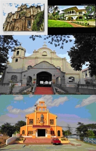
Today, according to the 2000 census, Camiling has a population of 71,598 people in 15,324 households. It is a 1st class municipality whose checkered history is colored with heritage and pride. Rebuilt in the 1880’s after a major earthquake, the century old Roman Catholic Church and Convent have been declared historical sites by the National Historical Commission in 1994. However, the Church was gutted by fire in 1997, That until today, its restoration has remained uncompleted.
Likewise, Camiling is also synonymous to Leonor Rivera who is Maria Clara, Jose Rizal’s fiancée in his novel Noli Me Tangere. Similarly, Camiling prides itself as the hometown of great men of valor and prominence, which include Carlos P. Romulo, former Secretary of the Department of Foreign Affairs and first Asian President of the United Nations General Assembly; Onofre D. Corpuz, former Minister of education, Culture and Sports, and UP President; Cesar A. Bengson, former Supreme Court Justice and Justice of the International Court in the United Nations; Alberto Romulo, former Senator of the Philippines, former Executive Secretary of President Gloria Macapagal-Arroyo and currently, Secretary of foreign affairs, among others. Camiling’s past remains unforgotten and it is resurging as it was.
CAPAS: MONUMENT OF HEROISM AND TOURISM
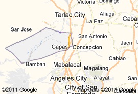
Capas was originally a town of Pampanga. It became one of the seven towns covered by the Politico-Military Commandancia in 1858 and became a town of the newly created province of Tarlac in 1873. At that time, Capas consisted of three barrios, namely: Murcia, Moriones, and O’Donnell.
Early residents of the town were mostly Kapampangans coming from the nearby towns of Pampanga. Later, migrants from Ilocos and Zambales also came to live in Capas
The oldest religious mission in the province was established in Capas as early as 1710. The Recollects must have founded it, judging from its patron saint, St. Nicholas of Tolentino, and a friar of the Recollect Order. The Augustinians, in fact, were active in the area since April 27, 1594.
Local government records indicate that Capas was created in 1712 and is among the oldest towns in the province of Tarlac. Its creation was justified by numerous settlements, which were already established in the riverbanks of Cutcut River since the advent of the 18th century. The settlements belonged to the domain of Pagbatuan and Gudya, the two villages unified by Capitan Mariano Capiendo when he founded the municipality. Due to the floods that frequently inundated the Cutcut riverbanks, the town was relocated to the upper area where it is now permanently established.
Etymologically, Capas derived its name from the vine capas capas, whose edible flowers are used as condiment for pinakbet. Another version indicates that the town took its name from a cotton tree, which is called capas (Ceiba pentandra Linn.) among the Ilocanos, bulak or kapok among the Kapampangans
Capas hosts the United States Naval Military Station until the Americans abandoned it during the powerful Mt. Pinatubo eruption in 1991.
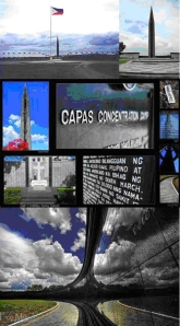
Similarly, it is the terminal point of the infamous Death March during the Second World War. The Capas Concentration Camp was originally established as Camp O’Donnell in 1940. The camp served as the prison site to more than 40,000 Filipino soldiers and 9,000 American soldiers who were prisoners of war of the Japanese invaders. About 30,000 of these prisoners died of diseases and severe starvation. In this concentration camp, the dead soldiers were simultaneously buried in single and shallow graves. The obelisk of the Capas Shrine entombs the names of the unsung heroes of World War II who died fighting for freedom.
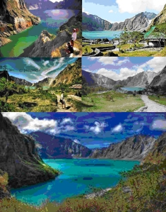
Capas is blessed with natural resources that brim with beauty and splendor. It is the gateway to the sensational Mount Pinatubo that buried the town with thick ashes in 1991. Today, the volcano’s river is a must to see by tourists.
As a tourist destination, Capas offers more than anyone knows: fine golf courses, spa centers, hot springs, mountain trekking, indigenous people, military camps, cuisine, street dancing and more.
CONCEPCION: CITADELA OF HEROES AND FINE CUISINE
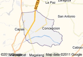
Concepcion lies on the southeastern tip of the province. Originally, it was part of Magalang, Pampanga until a great flood in 1863, which sent its inhabitants fleeing to safer grounds. The inhabitants went to two directions. Those who took the southeastern side of San Bartolome went as far as Magalang near the slopes of Mt. Arayat. Another group went to the northeastern side selected the present location and called it barrio Matundok or Matondo. The settlers included the Yumuls, Castros, Dizons, Pinedas, Felicianos, Aquinos, Cortezes, Bermudeses, and many others.
The early settlers in Concepcion cut down trees to build their huts. The place was generally flat that made it suitable for agriculture. Two rivers, the Lucong and Parua, irrigated the area where they planted rice and much later, sugarcane.
They brought with them an image of the Immaculate Concepcion from whom they sought protection in their new home. Later, they named their town Concepcion after the Virgin of the Immaculate Concepcion who, according to the people, is miraculous.
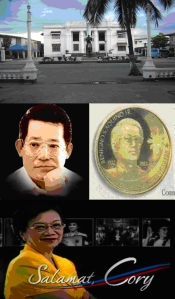
Hallowed with numerous intellectual and heroic sons and daughters, Concepcion is the hometown of Benigno Ninoy Aquino, the greatest Filipino martyr of the modern times, who is married to Corazon C. Aquino, 11th President of thePhilippines.
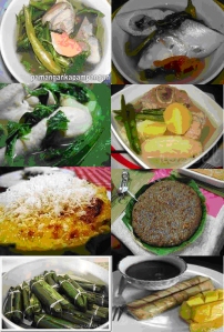
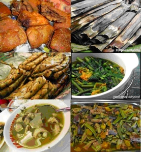
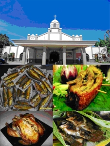
Concepcion is synonymous to excellent food. It is the bowl of fine cuisine and exotic foodstuffs. Endowed with the Kapampangan tradition of preparing food, Concepcion soars high because of its admirable and first-rate culinary arts.
GERONA: HOME OF AESTHETIC CRAFTS
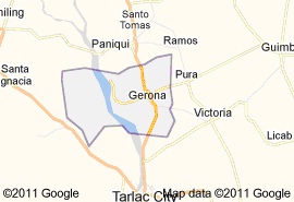
Historically, the original name of Gerona was paontalon. Old folks claim that Paontalon was probably a Negrito word. This is reinforced by Dominican sources, which recorded the presence of Negritos in the area as early as 1704. The Dominicans reported that they covered a place called Paontalon, whose inhabitants were all Negritos. By 1718, Paontalon was listed as a visita of Paniqui (at that time, a town of the province of Pangasinan). In 1753, Pontalon was relocated and renamed Barug, a Pangasinan word for “little forest.” Sources do not give any explanation why this was done subsequently; settlers from Ilocos were attracted to Barug, especially those from the towns of Bacarra, Badoc, and Sinait. Gradually, the settlers who grew in numbers occupied the forest.
The Dominicans supervised the visita in Barug, which only had some seventy families. The number rose to 461 in 1787. The Dominicans chose St. Catherine of Alexandria, virgin and martyr as the patron saint of Barug. The parish priest of Paniqui came once a week to say mass in the visita. In 1846, a parish priest was permanently assigned to attend to the spiritual needs of the community. The assignment of a parish priest to Barug coincided with the traditional date of its founding as a civil town. Thus, most town histories record the founding date of Gerona as 1846. However, Jean Mallat, in his travel account, explained that Barug (which he spelled as Baruc) was a town already existing in 1838 with 252 tribute payers and 1, 260 inhabitants. In any case, the name Barug was later changed to Gerona in 1851, after the Spanish hometown of the governor general, Claveria.
A document signed by a certain Father Ciano dated June 13, 1877, described the ethnic groups residing inGeronaas speakers of four languages: Pangasinan, Ilocano, Tagalog, and Pampango. Of these, Ilocano was the most widespread. Similarly, this account still holds true even nowadays. Based on the 1995 census, about 78.09% of the total household population speaks Ilocano, while Tagalog is spoken about 12.59% of the population, followed by the Kapampangans with 8.83%, respectively.
Geronawas officially created as an independent municipality onJuly 14, 1945. Its first appointed gobernadorcillo was Don Anacleto Melegrito.
Basically, it is an agricultural hamlet. This is why its huge flat rice lands are suitable and attractive to native and migratory birds called great heron. Hence, the Spanish word Gerona.
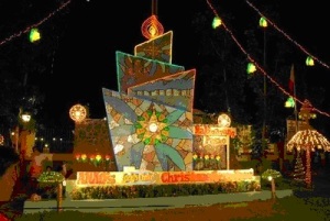
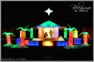
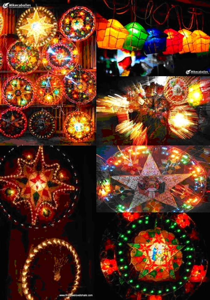
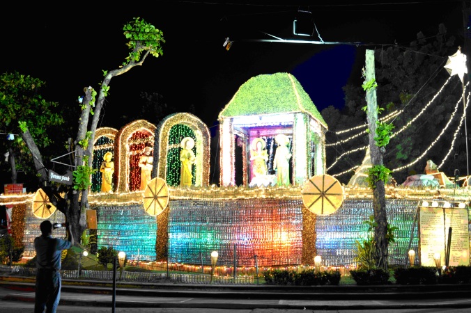
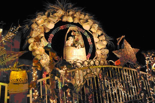
Considered as the halfway to the northern and southern Luzon areas, it is a fast growing town that teemed with thriving and blooming trade and industry. It prides itself with its aesthetic crafts in Christmas lantern making and the cabiaoan tradition of sugar cane production.
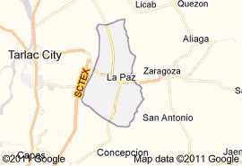
LA PAZ: THE CORRIDOR OF UPCOMING MARKET GROWTH AND BOOM
Like most other towns, the history of La Paz is recalled somewhat vaguely because it was dominated largely by legends and folklores, tainted with concommitant tragedy and mystery. Early chronicles state that there was once an old pueblo called Cama Juan that was situated along the banks of Chico River bordering theProvince ofTarlac, and Nueva Ecija.
Due to the overflowing of the Chico River, the whole pueblo was flooded. Cama Juan was totally devastated; its dwellings were destroyed; and scores of human lives were lost. Those who survived the flood evacuated and searched for a better place. They resettled on higher grounds not far from Cama Juan. The old site (Cama Juan) is up to this time being referred to as Bayang Iniwan or abandoned town.
Amidst the verdant field of grass and shrubs, the flood survivors began a new life. They called their newfound place, matayumtayum due perhaps, to the presence of abundant indigo vines called tayum (Marsdenia tinctoria R. Brown). The place flourished again through the constant hard work and industry of the people. Hence, the new settlement prospered in time and peace and tranquility reigned among the people. Under the paternal guidance of the older folks, the settlers maintained their seat of government in the said place.
Nearing the tides of the 19th century, General Francisco Soliman Macabulos, who became one of the foremost leaders of the Philippine Revolution, had conceived the idea of selecting the central site of the town at the where it stands at present.
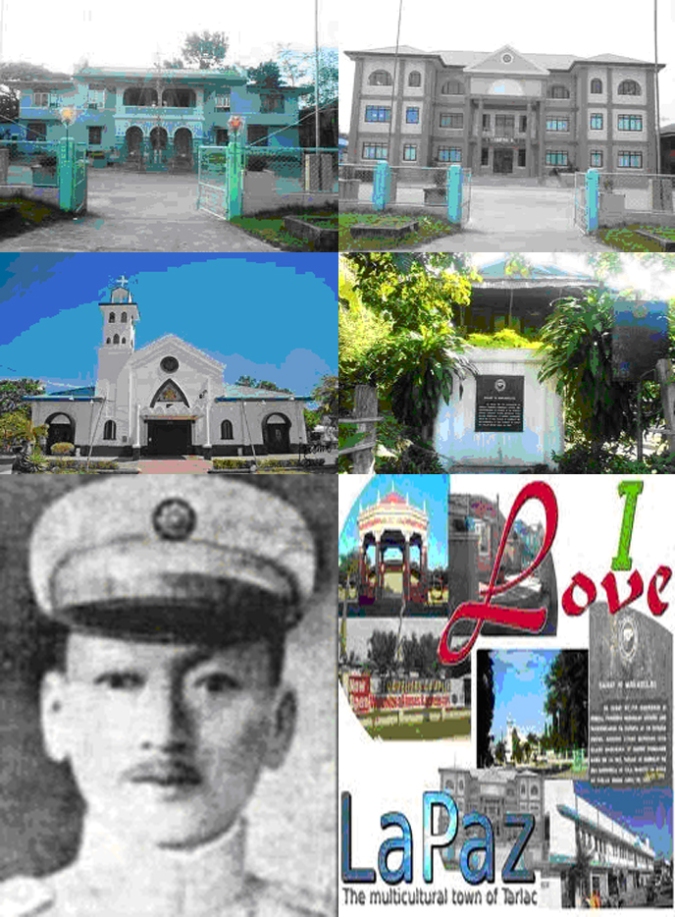
For a long period,La Paz existed in name only for actually and politically; it was a barrio of Tarlac town up to the year 1892. During the same year, it was separated from the town of Tarlac and was created as an independent town. It was re-christenedLa Paz, in honor of the Patron Saint, Nuestra Senora de la Paz y Buen Viaje, with Don Martin Aquino as the first gobernadorcillo.
Later on, due to the heroic exploits of the town’s revolutionary forces,La Paz was made as the first seat of the Local Government of the Province of Tarlac with General Franciosco S. Macabulos as its first Provincial Governor.
A serene town, La Paz will soon become the next corridor of economic growth and boom. Closely situated between the progressive towns and cities of Tarlac and Nueva Ecija, La Paz intersects itself to the economic growth centers of the Subic-Clark-Tarlac- Expressway (SCTEx). Soon, La Paz boom will definitely be unabated.
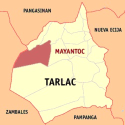
MAYANTOC: HALLOW GROUND OF NATURAL CALM AND SERENDIPITY
The first settlers of Mayantoc before the coming of the Christian migrants were the Negritos of the Abelling tribe. As the former arrived in great number, the natives were soon forced to move deeper into the forest areas of Zambales Mountain Range.
The Christian settlers, mostly from Ilocos region (notably the towns of Cabugao, Tagudin, Sarrat, Paoay, Sinait and Bacarra), settled in the villages in the southern portion of a then Christian town Camiling, now acknowledged as the mother town ofMayanatoc. The place was then a forested area where enormous rattan palms are found.
In 1899, Mayantoc was created as a barrio of Camiling and was inaugurated into a town on January 1, 1917 with Don Francisco Santos y Pascual, the founder of the town, as its first Municipal President.
In this historical town, General Francisco Macabulos established his military hide out during the revolutionary government.
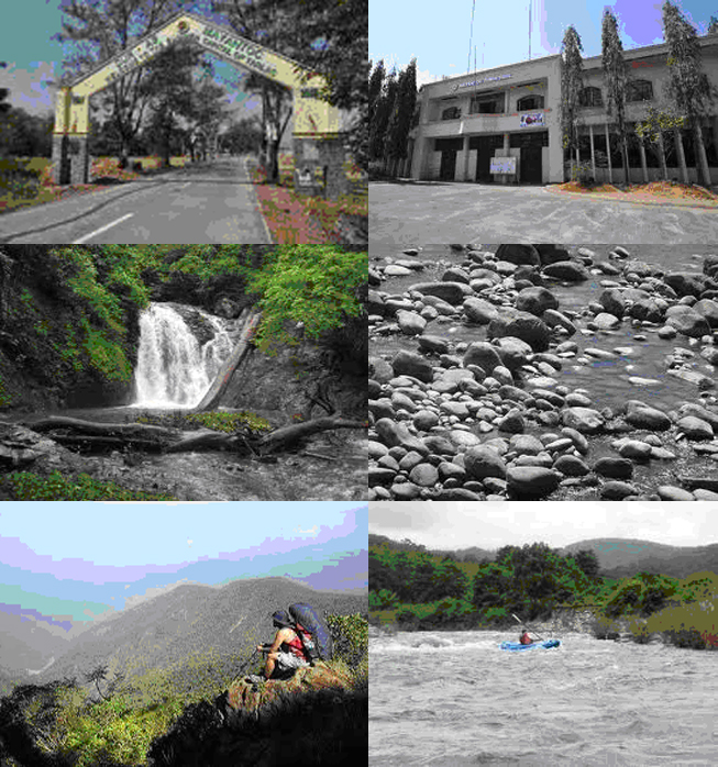
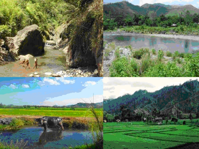
Mayantoc is a serene hamlet whose hallow ground is a picturesque of natural calm and serendipity. Geographically landscaped with graceful hills and mountains, its falls and streams are breathtakingly gasping and awesome. Aptly, Mayantoc is called as the Summer Capital of Tarlac. A potential tourism destination, the town’s sightseeing treasures and attractions need to be nurtured and discovered.
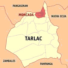
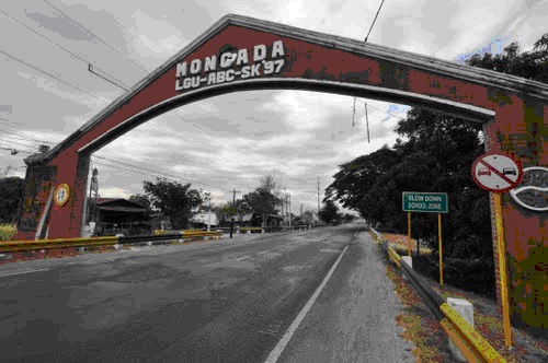
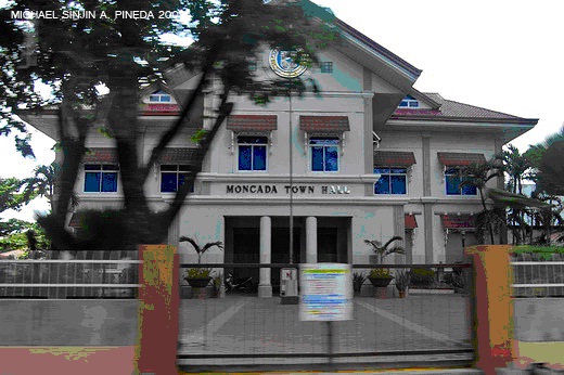
MONCADA: AN EMERGING EMPORIUM OF COMMERCE AND TRADE FAIRS
In the early years of the 1860s, four families from the barrio of Magaspac, Gerona, surreptitiously left their homes for fear of the Spanish curate, Father Modesto Perez. They settled in Sitio Caarosipan, the northern part of Paniqui. When the place became flooded and their crops were destroyed, they sought higher grounds and resettled in Sitio Payakan. The bounties of the place attracted other people from Pangasinan and Ilocos. These people joined those who were from Magaspac. Its people being hardworking, the sitio grew into a town. Later, it was named San Ramon in honor of their patron, Saint Raymond Nonnatus.
On May 1, 1845, a royal decree was issued by the Ministerio de Ultramar converting San Ramon into a town independent from its mother town, Paniqui and changing its name to Moncada.
Moncada lies in the northern part of Tarlac. It is bounded in the North by the municipality of San Manuel, in the West by Camiling, in the East by Anao, and in the South by Paniqui. It is comprised of 33 agricultural barangays and 4 poblacions with a total area of 8,575 hectares.
A third class municipality, it has a population of 49,607 people in 10,144 households (NSO, 200).
Beyond its traditional tobacco crops, Moncada is fast emerging as an emporium of commerce and trade fairs in the province today. Trade fairs enliven the industrial and technological ingenuities of the Tarlaquenos as craftsmen and entrepreneurs. As a manifestation of economic synergism, Moncada continues to strive forward towards progress and development and beyond time and standards. As an effect, the dignity of every Moncadeno benefits from the fruits of the town’s budding boom and economy.
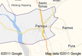
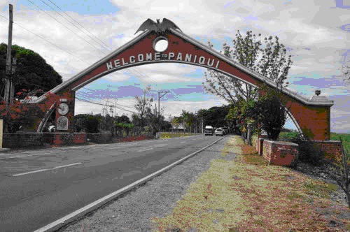
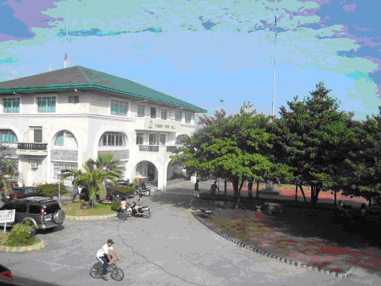
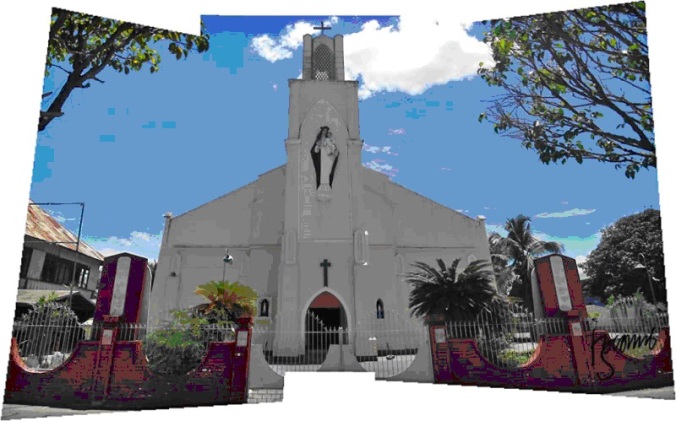
PANIQUI: CITADEL OF ANTIQUITY
Paniqui was originally a part of Pangasinan and thus was listed in the Actas Capitulares as the oldest town founded in 1754 by the Spaniards. It became a parroquia (parish) of the Dominicans in 1686. It was raised into a Vicaria (vicariate) with Fr. Jose Sanchez as its first pastor in 1718.
At first, Paniqui was situated west of Tarlac River. Because of the attacks by Negritos, the Spaniards decided to move the town east of the river. But, because of flooding, it was moved several times until it was settled in acocolao, two kilometers from the present town. Sometime in 1720, Paniqui, as claimed by Raymundo and Miguel Paragas of Dagupan, became a sitio of Dagupan. Led by these two brothers, the sitio was called mangang marikit where bats or paniki swarmed at twilight. Today, mangang marikit is a part of Guimba, Nueva Ecija. It was in sitio acocolao where Sultan Alimudin was baptized in 1750.
The two rivers passing through the town from Nueva Ecija more than likely enriched the plains of Paniqui, enabling the people to raise coconuts, mangoes, and oranges such as cajeles and naranjitas. They also produced abundant rice. Thick forests covered the northern part of the town. They had molave, narra, canala, yakal, and other hardwood, which are good materials for construction and furniture making. Paniqui also had plenty of cotton trees, cacao, and coffee.
The original inhabitants of Paniqui were pure Pangasinenses. They lived near the center of the town, an area reached by the sound of church bells. The rest of the settlers were mostly Ilocanos who came during the 1830’s. Father Ramón Sanchez observed in 1869 that the different ethnic groups did not seem to mix with each other, keeping their languages to themselves (i.e., Ilocano, Pangasinan, Pampango, and Tagalog). Spanish was of course, spoken by the friars and officials of the Spanish government.
Paniqui was a sprawling town that covered a wide area during its early years. Some of the villages which were formerly portions of the town included San Roque now Cuyapo, Nueva Ecija; Barong now Gerona, San Jose de Camiling now Camiling, Bani now Ramos, San Ramon now Moncada, and Anao.
Today, industrious and frugal Ilocano settlers, aggressive yet peaceful Kapampangan immigrants, generous Pangasinenses, and liberty loving Tagalogs people the town. It is a thriving and progressive community with a total population of 78,883 (NSO, 2000). Falling within the belt of the melting pot of Central Luzon, every ordinary citizen of the town speaks with fluency the Ilocano, Kapampangan, Tagalog and Pangasinense languages.
Prominently situated along Mc Arthur Hi-way, Paniqui is a trade and commerce emporium. It hosts educational institutions, commercial and rural banks, a sugar mill, progressive public market, bold and devout people and vibrant culture.
As a citadel of history, Paniqui is a testimony of the past and present. Welded with strong determination and persuasion, these Tarlaquenos of Paniqui are working zealously to bring into it the Capitol of Tarlac government.
PURA: BASKET OF CROP FRESH PRODUCE
It was during the Spanish regime when migrants coming from the Ilocos Region moved southward to look for arable lands. These early settlers were forced to abandon their place of birth because it had a narrow coastal plains and highlands where agriculture is not a promising means of livelihood.
These migrants decided to stay on the northeastern part of a future province later known to be TARLAC. The place at that time was thickly forested and so they took the initiative of clearing the area for agricultural purposes. Because of kinship, they considered themselves pure Ilocano settlers of the place; hence, they named the place “pura”. Ethno-botanically, however, the name of the place is attributed to an obsolete Ilocano term”purak” (also called pandan lalake or pandan dagat) which enormously thrived in the area during those days because of its proximity to the huge Chico River. The river thrived with mangroves at that time where “purak” abundantly grow.
Pura began as a barrio of Gerona known as Barrio De Villa. As its settlers grew, a clamor for a township arose. Hence, its leaders filed a petition to the proper authorities to have the settlement converted into town. In 1877, through the initiative and efforts of Fr. Pedro Graneta, Pura won and enjoyed its bid for political status as pueblo or town.
In 1908, Don Felix Melegrito was appointed as the first Presidente Mayor under American regime. In 1941-1944, Gabriel Nebre was the last Mayor before the war while Mayor Pedro Parcasio was the first Mayor after the war 1945-1952 followed by Mayor Nestor Gamit – 1963-1971, Severino Valdez – 1972-1975, 1976-1979, Nestor Gamit 1980-1986, Pioquinto Cortez – 1998-1992, Wilfredo Y. Sawit – 1992-1995, Nicolas Uy – 1995-1998, Mario Maddela – 1998-2001 and in 2001 was Wilfredo Y. Sawit. The people derived their livelihood from its vast agricultural lands where they raised sugar and rice as major crops.
RAMOS: IDYLLIC TOWN OF NUPTIALS AND FEASTS
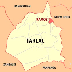
The Municipality of Ramos is located at the northeastern part of the Province of Tarlac. It is approximately 28.6 kilometers away from Tarlac City. It is geographically bounded by the Municipality of Pura in the south (5.1 kms), Municipality of Paniqui at the northwestern part (7.1 kms), Municipality of Gerona at the southwestern part (10.9 kms), Municipality of Anao in the northern part (10 kms), Municipality of Nampicuan, Nueva Ecija in the northeastern part (10.5 kms) and municipality of Guimba, Nueva Ecija at the southeast (23.1 kms).
Ramos is a barrio of Paniqui until it was converted into a town in 1921. Originally named bani, it was later named after its founder, Don Geminiano Ramos and Don Alfonso Ramos (who was a governor of Tarlac).
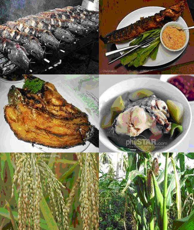
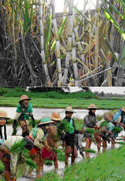
Agriculture is the chief source of its economy that includes rice, vegetable, sugarcane and mango production. Fishing is a supplementary source of income for the people of the town.
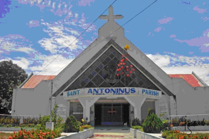
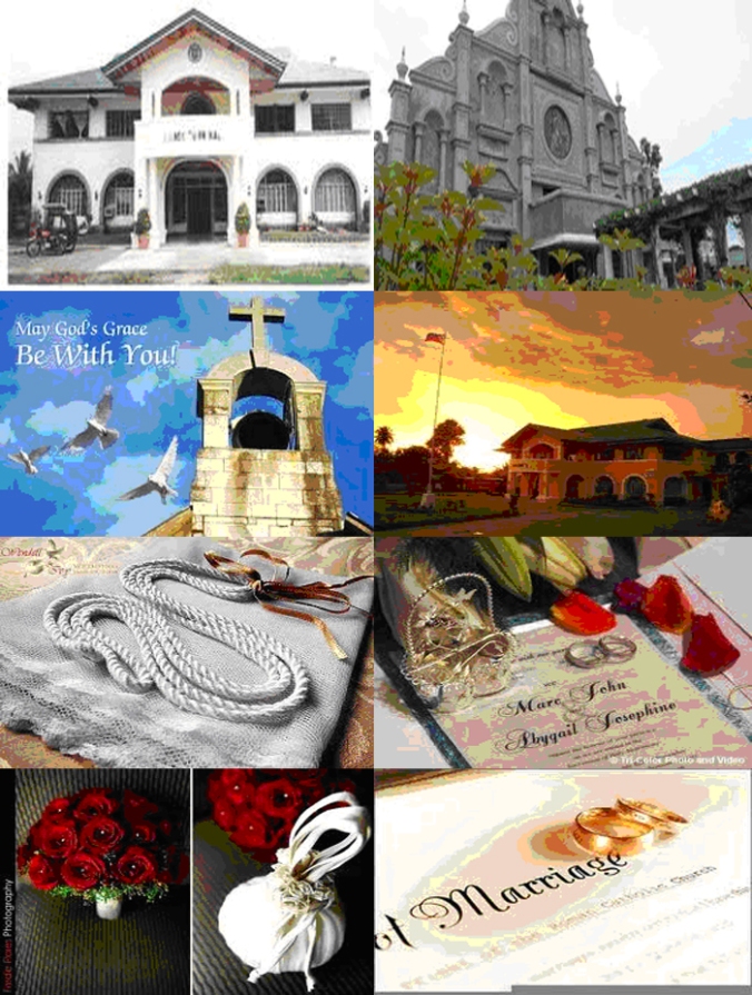
It has a population of 16,889 (NSO, 2000). The people are mostly Catholic and the town’s Catholic Church, St. Therese of the Child Jesus, is popularly called Wedding Church of the Century. Its Catholic church is simple, yet, enormously beautiful and famous.
SAN CLEMENTE: FOOD BOWL OF TARLAC
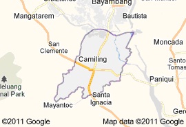
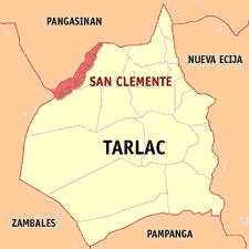
San Clemente, formerly a sitio of Camiling is located on the westernmost part of Tarlac. Oblong in shape, it is between themunicipalityof Camilng in Tarlac and themunicipalityof Mangatarem in Pangasinan. Its early settlers were the industrious Ilocano who came from Ilocos Norte and Ilocos Sur.They settled in sitio San Clementein search of fertile agricultural lands. To be able to farm, they burned and cut down trees.
Based on archival records,San Clemente was created as a town by virtue of a superior decree dated November 14, 1876. It consisted of barrio Macarang, which was taken from the town of Camiling, and barrio Taguipan that was detached from Mangatarem, Pangasinan. The superior decree establishing San Clementeas a town was affirmed by a royal order dated June 10, 1879.
Records indicate that the early settlers of this town, said to be the Dumlao, Trini-dad, Loria, Espiritu, Martin, etc., were mostly of the Ilocano stock who came from the Ilocos Region in a quest for better economic opportunities in the abundantly fertile agricultural lands. These prominent people were indeed endowed with the vision to transform their adopted abode into a wholesome place to live. Thus, local governance has always been viewed at the socio-economic development perspective. The local chief executive position then did not only entail the laborious task of administration but also the shelling-out of sizable pecuniary contributions to pursue a project… up to the extent of donating tracks of land for public utilization. The public plaza, market, municipal building, school buildings, church, etc., were constructed on donated lands.
Structures in the locality reminiscent of the past era of colonization such as church, school buildings, houses, bridges, etc. have gradually given way to the modern day’s engineering designs for relative purposes. The venerable tradition of the Filipino hospitality however, remained alive and in practice – where every visitor is genially accorded the honored guest treatment.
To these days, the descendants of the early families still maintain their residency to perpetuate the legacy of productivity left by their ancestors. Consciously instilled, industry, which characterizes their Ilocano predecessors, is likewise evident. Through the years, the industrious townspeople toiled enough to realize the economic sufficiency everyone claims for. Modesty aside, modern day technological advances for domestic comforts are ubiquitous in majority of the households. The people rely mainly on farming as a source of livelihood; nowadays, local labor resources have gone their way overseas for better and more lucrative opportunities to improve their lot.
The municipality owes its growth mainly to the industry of its townspeople and to the public officials who took the cudgel one after another in the quest for prosperity. The election held in 1915 catapulted the first highest municipal official by the title, Presidente Municipal, the equivalent of Municipal Mayor in today’s structure. The chronology of the mayoralty terms of office is purposely detailed hereunder in order to give tribute and relive the legacy they have in one way or another mustered during their time.
SAN JOSE: HAMLET OF RUSTIC BEAUTY
Before San Jose became a town, the barangays comprising the municipality remained in state of lassitude. Socially and economically, no significant signs of progress can ever be seen for many years. Illiteracy was high and health sanitation was very inadequate. These circumstances required the people to unite. Led by then ABC President of Tarlac town, Amado de Leon and Samuel M. Eugenio, then barangay captain of Mababanaba and current Vice-Mayor of San Jose, passed a petition creating themunicipalityofSan Jose, which was submitted to President Corazon C. Aquino. The municipality was to comprise 13 barangays.
As early as 1927, the creation of this western part of Tarlac town into a municipality was already conceived. During the same year, the late Don Benigno Aquino, Sr., together with Rev. Gregorio Aglipay, founder of the Aglipayan Church fêted the approval of the change of name of Cadaanan into Villa Aglipay, in honor of Monsgr. Gregorio Aglipay, and at the same time, declaring it officially as a barrio. On that occasion, Don Benigno Aquino, Sr. vowed for the creation of the community as a municipality in this western part of Tarlac, Tarlac with Villa Aglipay as the municipal site. This however, did not materialize because of the untimely demise of Don Benigno Aquino, Sr.
Later, this dream was to be pursued by Benigno Ninoy Aquino, Jr. As governor of Tarlac, he envisioned the same by making San Jose as the site of the Provincial Capitol and to make Tarlac town, a city. However, for political reasons, this plan was shelved. Events further dampened that vision when Martial Law was declared in 1972. Ninoy Aquino did not live to see the birth of San Jose when he was assassinated on his return trip to the country in 1983.
The petition creating San Jose into a municipality was made possible through the efforts of Hon. Jose G. Macapinlac, Mayor of Tarlac, Hon. Jose Cojuangco, Governor of Tarlac, and Hon. Jose V. Yap, Sr., Congressman, 2nd District of Tarlac. Soon House Bill No. 5619 was filed in Congress for enactment. The House of Representatives and Senate passed Republic Act No. 6842 creating the municipality of Jose on September 1, 1989 and October 3, 1989, respectively. The Act was approved and signed on January 5, 1990 by her Excellency President Corazon C. Aquino. Submitted to the people in a plebiscite, majority of voters ratified the Act, thus, making the municipality of San Jose, the 18th town of the Province of Tarlac. In administering the governance of the town, President Aquino appointed municipal officials led by Jose V. Yap, Jr. as Municipal Mayor, Samuel S. Eugenio as Vice-Mayor and 8 Municipal Councilors.
Today, the rustic hamlet of San Jose is striving to become an agro-industrial town. The local government and non-local government agencies are currently undertaking development plans to make certain its visions are realized. Citizen participation ensures the benefit, growth and sustainability of the town.
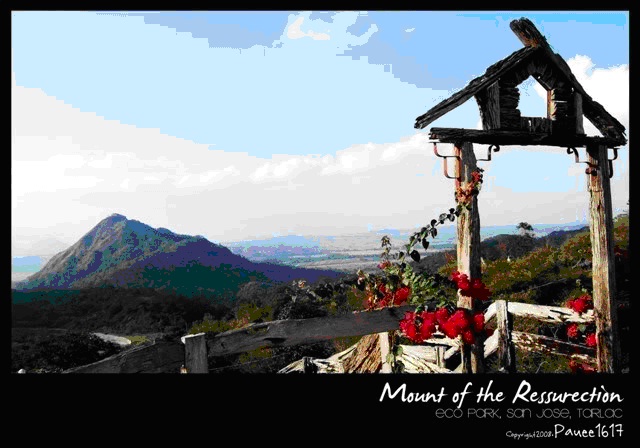
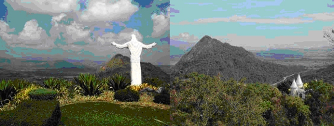
Dubbed as the eco-tourism park of the province, it is noted for its graceful mountains, hills, cascades and greeneries. It hosts the well-known Monasterio de Tarlac that enshrines the consecrated relic of the Holy Cross of Jesus Christ.
SAN MANUEL: BORDER TOWN OF A BOOMING ECONOMY
San Manuel is known to be a forest covered with thick marshes and grasses during the earliest times. It is also covered with dense marshlands, lakes and creeks. Wild animals gamely roamed into the woods and wilderness until the adventurous people from Zambales and Pangasinan discovered the fertile grounds of the area. Later, migrants from the Ilocos region settled into the lush green fields of the place and started new life. The settlers cleared the lands using their crude implements and started growing rice and corn. The early settlers also engaged in hunting wild deer, pigs, birds and other forest animals to sustain their subsistence.
The town of San Manuel was the biggest village of Moncada and was called San Jose in 1902. In 1909, it was converted as a town, and was name in memory of its founder, Don Manuel de Leon.
When the prosperous village of San Jose was separated from the town of Moncada, the jubilant and proud people of the town grouped themselves together to intensify the progress and development of the municipality.
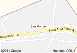
The municipality of San Manuel is bounded on the north by the province of Pangasinan, the province of Nueva Ecija on the east, municipality of Anao, Tarlac on the south and the town of Moncada, Tarlac on the southwest. It has a population of 22,747 (NSO, 2005) and its economy is totally dependent on agriculture.
San Manuel as a border town is gradually booming with economy. Its robust agriculture generates agro-industrial enterprises that largely sustain its economy. Small business and industrial establishments begin to show and grow. This indicates boom and confidence. San Manuel has a young economy, yet, it is surging high and beyond.
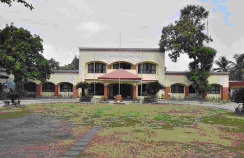
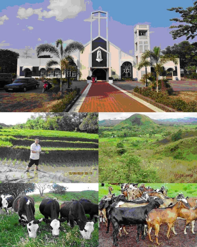
SANTA IGNACIA: TOWN OF INTREPID ARTISANS
Historically, the first inhabitants of Santa Ignacia were Negritos, but were driven to the mountainous portion of the province when the first migrants from Ilocos, lead by a man whose family name is Madriaga, occupied the place. The new settlers called the place binaca, an Ilocano word which means plenty of cows. Up to 1845, Binaca (now Nambalan) was a barrio of Camiling. Robbers, from 1845 to 1874, plundered the barrio. This forced a petition for Binaca to become a town, with Don Felipe Cabugsa as its gobernadorcillo, in order that it could have its own police force.
A superior decree dated May 6, 1874, modified by another decree dated May 22, 1876, called for the creation of barrio Binaca into a civil town, and named it Santa Ignacia. These two decrees were approved by a royal decree dated August 13, 1880. Occasionally, the parish priest from Camiling performed spiritual service for the town.
Despite being upgraded to the status of a town, the area continued to be the target of attacks by thieves or tulisanes who stole the work animals and personal belongings of the residents. Again in 1888, robbers forced their way into Santa Ignacia, looting all they could get including the timbre del tribunal (official seal).
In 1899, during the administration of Don Manuel Briones, Presidente Municipal, a revolutionary government was established in Santa Ignacia but later, was taken over by the administration of the United States of America.
On January 1, 1914, after the intervention of the Provincial Board of Tarlac and upon the insistent demand of the people that the first Municipal Council of Santa Ignacia was inaugurated composed of Don Isidro Alviar as the Presidente Municipal; Don Eulogio Madriaga as the Vice-Presidente, and Don Santiago Aviguero, Don Pedro Guerrero, Don Silvestre Lacuin, Don Alipio Pascasio and Don Antonio Colimay as Councilors.
Subsequently, the municipality has evolved as a surging commercial town today.
Then and now, Santa Ignacia’s fertile and rich agricultural lands are its chief livelihood, which is largely based on farming. Its major crops are rice and different fruits and vegetables.
Endowed with the Ilocano tradition of pottery making, the rustic town of Santa Ignacia is well known for the production of high quality earthen pots and other terracotta products.
Beyond agriculture and terracotta, Sta. Ignacia creates itself as an emerging town of intrepid entrepreneurs and hardworking artisans. It produces fine handicrafts, sculpture, smoked fish stuffs, and the famous inangit product.
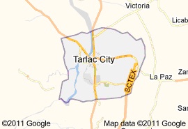
THE COSMOPOLITAN CITY OF TARLAC
The city of Tarlac has had a colorful and significant history. Its story may very well be the story of Tarlac province itself, which came into being only in 1873-74, eighty six years after Tarlac town was formally founded in 1788.
Tarlac town may be the earliest native settlement occupied by the Spanish military force, this side of Pampanga. Based on records, Tarlac was organized into praesido (fort) as early as 1593. It was one among several forts set up to maintain Spanish sovereignty in the area. The fort was located in a sitio called Porac.
By 1686, Tarlac was raised to a Spanish pueblo. That same year, it became an ecclesiastical town but still dependent on Porac for civil administration. Priests from Magalang, Pampanga administered it.
In 1788, Tarlac was raised to a civil town independent of Porac while remaining a town of Pampanga province. Tarlac town regained its civil town status when it became one of the towns of the newly created province of Tarlac in 1873. Thus, its population steadily grew. From 900 souls in 1732, it rose to 2,273 with 1,230 paying tributes. By 1855, Tarlac had 7,920 inhabitants (12 Europeans and 7,908 indigents). They spoke Pampango, Ilocano, Tagalog, Pangasinan, Español, and Zambal. This number increased to 12,340 in 1890.
Since then, the magnitude of its population has enormously increased. The 2000 actual census on population conducted by National Statistics Office, Region III, shows that Tarlac town (now Tarlac City) has a population of 262, 481. Based on the 1995 census conducted by the NSO with in Tarlac City, the Kapampangan language represents 75.22% as spoken by the people, Tagalog (14.58%), Ilocano (8.55%) and other ethnic languages (1.65%), respectively.
Its early settlers came from Bacolor, Pampanga, among them were Don Carlos Miguel and Don Narciso Castaneda, who before 1788, with their families and followers trekked through the forests and hills of Porac and Bamban until they finally reached and settled down in what is today called Tarlac City. They cleared the forest and tilled the fertile soil until a settlement emerged along the riverbank, which flowed across the town.
The community rapidly grew with settlers coming from Zambales, Pampanga, Bataan, Pangasinan, Bulacan, Nueva Ecija and elsewhere. The kapampangan language became the lengua francain the community, as it was part of Pampanga province in those days. The two leaders, Miguel and Castaneda succeeded in carrying out their pioneering venture through benevolent leadership, which elicited the cooperation of their followers. Thus, roads were built; barrios were established without monetary expenditure, only through the common efforts of everyone. It also marked the beginnings of Tarlac as a melting pot ofCentral Luzon, with a mixture of divergent people working decidedly for the common good.
Later, it was unanimously agreed by the growing populace to request the authorities in Manila to convert the community into a town. Don Carlos Miguel prepared the needed resolution and forwarded it to the Spanish authorities. In 1788, a decree was issued by Captain General Don Felix Berenguer de Marquina, proclaiming Tarlac as town under the territorial jurisdiction of Pampanga, whose capital then was Bacolor.
The first gobernadorcillo (later called municipal) was Don Carlos Miguel in 1788. Together with Don Narciso Castaneda, he established the foundation of Tarlac town. Don Luis Briones in 1789 followed him. It was during his term as the second gobernadorcillo that the Legend of San Sebastian started. It is said that sometime that year, an armed band of tulisanes were stopped from marauding the town by the young boy who turned out to be no less than San Sebastian himself.
Tarlac is represented prominently in the eight rays of the Philippine flag because it was among the first provinces to join the revolution in 1986. The K.K.K of Andres Bonifacio found early adherents among Tarlaquenos, headed by Don Francisco Tanedo, after whom the town’s principal thoroughfare was named. Don Francisco Tanedo was killed in the encounter with the Spanish guardia civil at the outset of the revolution. His early death inflamed the citizenry and his relatives. Followers were bent on capturing the town by any means, but were dissuaded by Don Eusebio Tanedo Iro,who volunteered to see his friend, General Monet (former politico-military) governor of Tarlac and at that time, the highest military official in Pampanga. Denying that the Tarlaquenos at that time were involved in the revolution, Don Eusebio was able to obtain orders from General Monet to stop military operations in Tarlac. However, peace did not reign long in Tarlac because Generals Francisco Macabulos and Jose Alejandrino already started their offensive against the Spanish forces .On June 25, 1898, Spanish soldiers surrendered in Tarlac.
The Miguels, descendants of one the pioneers of the town, Don Carlos Miguel, changed their family name to Tanedo in 1872 upon the promulgation of the Claveria decree on surnames. It is said that the Miguel preferred the masculine version of Castaneda, and Tanedo was also in compliance with the designated starting letter for all Tarlac surnames. It is therefore, not surprising that many Tarlaquenos to this day bear such surnames as Taala, Taar, Tabamo, Taban, Tabaquero, Tamayo, Tamondong, to name a few.
President Emilio Aguinaldo proudly proclaimed the Philippine Republic onJanuary 23, 1899in Malolos, Bulacan. Assemblance of an independent government was formed, with a law making body, Malolos Congress, a cabinet headed by Apolinario Mabini (who was foreign affaires minister), a judiciary, and of course, an army led by General Antonio Luna. A state university, the Universidad Literaria de Filipinas, was also opened.
By July 1899, with the tides of war turning against Aguinaldo, Tarlac became the last capital of the short-lived republic which was then on the run. Among the deputies who were in Tarlac to attend sessions of Congress included Fernando Ma. Guerrero of Manila, representing Leyte; Daniel Tirona of Cavite, representing Batanes; Tomas Mascarado of Batangas, representing Sorsogon; Servillano Aquino of Tarlac, representing Samar; and Fransisco Macabulos of Tarlac representing Cebu.
Since 1788, the town has significantly progressed making it the nucleus of Tarlac province. It has encountered countless hardships in the course of its existence. Through the years, Tarlac has survived natural and political crises among others, yet, has proven itself as a fast emerging cosmopolitan in the region.
Proclaimed as a component city onApril 19, 1998 by virtue of Republic Act No. 8593 to be known as the City of Tarlac, Tarlac City is bustling with economy, industry, commerce, tourism, culture, ethnicity and spirituality.
As a cosmopolitan city, it nestles a great future of wealth and prosperity. With the emergence of mega-structures along its periphery, Tarlac City is in the road map of economic boom and miracles. Undoubtedly, its cosmopolitanism makes itself as the next terminal of progress and development.
LA VICTORIA: PUEBLO PATRIMONIO DE TARLAC
(HERITAGE TOWN OF TARLAC)
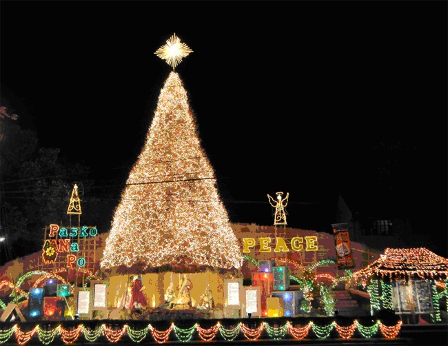
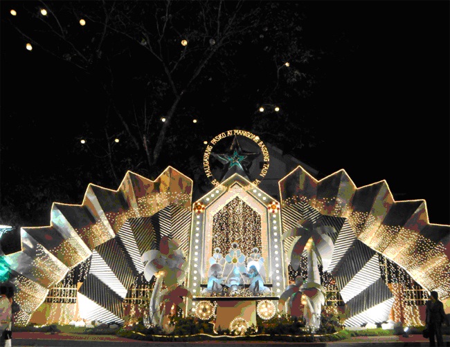
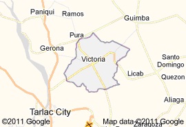
Victoria was originally called Canarem, after lake canarem. It was a barrio of the town of Tarlac when the latter was still part of Pampanga province. It was renamed La Victoria by governor-general Manuel Gorospe through a decree issued on March 28, 1855, to commemorate the victory of the carlitas, the supporters of Queen Isabela during the Civil War.
The earliest inhabitants of the town came from the Ilocos regions. Between 1849 and 1851, Victoria’s fertile lands lured them. The settlers chose to reside along the lake where fish was abundant. Their first settlement was known as Namitinan, which became barrio San Vicente de Bautista of Tarlac town in 1852.
The other pioneers came from the towns of Sta. Lucia, Ilocos Sur and from Badoc, Ilocos Norte. They built their homes adjacent to each other. In 1852, with the increasing number of population totaling 4, 600, the Spanish authorities designated Don Andres Rigor and don Vicente Taguinaldo to serve as cabezas de barangay.
On November 25, 1854, the residents led by two cabezas de barangay, filed a petition to the government in Manila and demanded that Canarem (still a barrio then) be separated from its mother town, Tarlac, a town in Pampanga at that time. The petitioners argued that they were already paying more than of 200 tributes, and that the Ilocano settlers called for the separation of Canarem from Tarlac, so they did not need to do community work outside their own. Governor General Gorospe approved the petition to separate Canarem and turn it into a new municipality. He, then, signed the decree making Canarem a civil town on March 28, 1855. As stated earlier, it was renamed Victoria, meaning victory to commemorate the victory of the loyal followers of Queen Isabela of Spain over the moors.
Although it became a municipality, ecclesiastically, Victoria remained under the jurisdiction of Tarlac town. Thus, on December 13, 1865, a group of principales led by Don Nicolas Rigor, Dionisio Marcelo, and Gabriel Valdez petitioned the Spanish authorities to establish Victoria as a parochial town ecclesiastically independent from Tarlac. The requirements for the opening of the new parochial town were already completed including the nearly finished convento and the tribunal house. Despite the scarcity of parish priests at that time, Governor General Jose dela Gandara y Navarro (1866-1869) brought up the matter to the consultative body of the Spanish monarch on November 26, 1866. As a result, the parochial town of Victoria was created on April 27, 1867.
On July 31, 1866, Governor General Fernando de Norzagaray issued a mandate instructing the governors of Pampanga and Pangasinan to establish the boundaries of Victoria and Tarlac. Seven years earlier, prior to this mandate, Fray Saturnino Pinto, the parish priest of Tarlac, ordered the pulling out of the fixed boundaries. This act was supported by some principales of Tarlac who objected to the creation of the municipality of Victoria for this would decrease the number of parishioners under Fray Pinto. As an offshoot of this incident, the boundaries of Sitio Baguia was also removed by Tarlac’s officials, and placed in Sitio Malawit. This reduced the size of Victoria by some two kilometers in width. It would appear that some elites among the Tarlaqueños during that time were against converting canarem into a town. Further, they found an influential ally in the person of the parish priest, Fray Pinto. It is purported that the parish priest gave the final approval to incorporate the sitios of Bulala, Paltoc, Narsigan, Pulong Ganla, Pulong Palico, and Kalamkan into the town of Tarlac, with the assistance of rich and influential landowners who in the course of time became the owners of those lands.
CULTURE AND BELIEFS
There were waves of migration, which formed Victoria: the Kapampangans and the Ilocanos. Being Christianized by the Spanish colonizers, Immaculate Concepcion became the town’s patron saint. The passion during Lenten Season is sung in three dialects. For example, in poblacion area, the Kapampangan version is chanted in San Fernando, Tagalog in San Gavino and Ilocano from the rest of the town proper. While Ilocano and Kapampangan are spoken in most of the town, Tagalog is also widely spoken in public places to facilitate universal understanding.
The presence of the three languages in the same town did not produce a pidgin tongue. Each language retained its integral and basic characteristics. While this continues to be the outstanding feature of the town, Victoria is a town of heritage (pueblo de patrimonio) treasured with beautiful history.
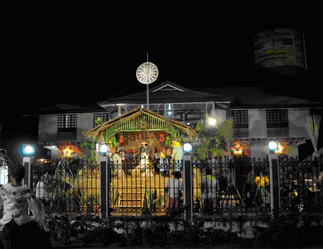
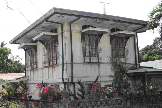
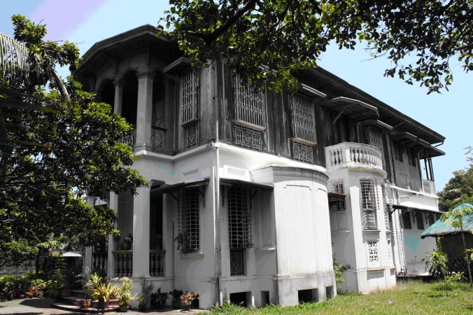
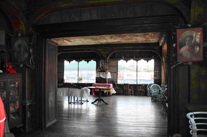
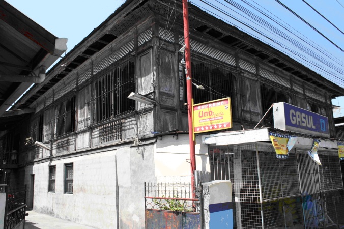
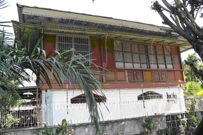
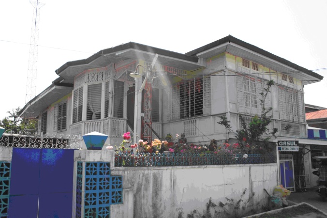
Today, Victoria has come a very long way. Now a third class municipality, it unveils its rich cultural heritage as it preserves its century old dwellings and other Spanish architectural designs of various edifices. As they may be partly ravaged by war or have remained intact and grandiose through the years, they capture the memoirs of the good old past.
Victoria may not be a prominent town but it is gradually becoming one. The magnetism it holds is its people’s smiles and simplicity and the hospitality they behold. The creativity of its people is manifested in their industry and resiliency; patience and perseverance as shown in their ability to stride above all trials, are distinguishing traits that they are very well known for.
Although modernization has influenced the progress and development of the town, the rich Victorian culture is sustained. Evidently, Victoria’s cultural heritage is a reminiscence of its traditional prominence and affluence.
Just like any town in the province, fiestas are still popular traditions, which are pompously celebrated by all. Fiestas are time-honored thanksgiving celebrations in honor of the patron saints that the people revere. Lenten season is observed with holiness and religiousness. Penitents devotedly practice panata by carrying wooden cross and the kalbaryos are also set up along the roadsides where the pasyon or the passion of Christ is sung. Processions are held on the afternoon of Good Friday and the salubong during the early dawn of Easter Sunday.
Come summer season, when flowers are in bloom, young ladies are once again enjoined to wear their gown for the Santa Cruzan as the highlight of May Festival.
Love for arts abound in this town. Talents are found everywhere. Local bands mushroom in almost every corner. Performing artists enthusiastically display their skills and prowess that awe the townspeople to surprises especially during the town fiesta.
Victoria may be a quiet town not imminent, so to speak, but this is an analogue to the humility of the town folks. Victorians would rather act than speak. They are people of performance and achievements rather than pronouncements and empty talks. For once, the sleepy town has finally risen up.
- Comment
- Reblog
-
Subscribe
Subscribed
Already have a WordPress.com account? Log in now.




















Isang mahalagang ambag sa karunungan ng mga Tarlakin ang inyong isinulat at tinipong impormasyon ukol sa mga bayan sa ating lalawigan. Salamat bagama’t Kapampangan kayo ay niyakap niyo ang Tarlac sapagkat kailangan namin kayo nina Sir Lino dahil wala naman nakikitang malasakit ang marami sa ating pamahalaan sa ating kasaysayang pampook!
xiao, salamat sa iyong mayamang pananalita na nag-aambag apoy upang lalo akong magpagal sa paghahanap ng larawan sa kasaysayan ng ating lalawigan – pangalawang balayan akin din minumutya na siyang magiging pugad ng aking himlayan pagsapit ng araw.
Malaki po ang maitutulong nito sa aking mga mag-aaral sa Don Bosco Technical Institute Tarlac dahil isa sa mga araw na ito ay maglilibot kami sa ating Lalawigan…
may roon tlga tyongmga yman
thanks po sa page na to…. it helped me in finishing my research about our town…thanks a lot po..
Maraming salamat po sa napakagandang historical backgrounds na ito. Truly proud to be a Tarlaqueño.
Ngayon po ay ang kaarawan ng ating bayani na si Gen. Francisco S. Macabulos.
Lemoure Jeff,
Baka nais mo na basahin ang History of Lubao, Pampanga. Dito ay makikilala mo ang tunay na pinagmulan ng iyong lahi bilang angkan ng mga unang dakilang Kapampangan. Mula sa Lubao ay dumako sila sa Tarlac na noon ay bahagi ng Labuad Kapampangan.
Cheers!
Kung gaano kayaman ang ating mahal na lalawigan at mga bayang bumubuo dito, ay siya din namang yaman ng mga karunungang ibinahagi mo sa amin sa iyong mga panulat hinggil sa makulay na kasaysayang inukit ng Maykapal sa ating minumutyang lalawigan, ang Tarlac.
Ikaw sa aking pananaw ay gintong marapat lamang pag-ingatan ng ating bayan dahil sa malasakit mo sa kasaysayan.
Nawa ay magpatuloy ang iyong pagkalap ng mga butil ng impormasyon na muli mong ikikintal sa aming mga uhaw na kaisipan.
ag yaman nak kingka!
agyaman met kabsat. dakal mu naman salamat abe!
this is an awesome website showing Tarlac…
nice one sir Rodrigo,, very informative po lahat ng ginawa nyo,,Keep it up sir!! Shelyn Guzman.. MaEd T.L.E
sa aking bayang minamahal!
kanluran ng araw ng kabataan>
Do you know the birth and death date of Don Narciso Castaneda?
Is it true that there’s a place in Bamban Tarlac like hectares are for sale by the native Aetas?
Yamanek iti amin dakkel nga tulong mo cadagiti Cailiam Sir.
Napakaganda ng iyong Website tungkol sa mga bayan na nasasakupan ng ating lalawigan Tarlac. Ito ay malaking tulong sa mga magaaral at sa mga kulang sa kaalaman sa kasaysayan ng bawat bayan. Kudos and keep up the good work! Isang munting paalala lamang; sa paggawa ng website at blogs kung gagamit ng larawan na galing sa ibang site ay maghingi ng pahintulot sa mga may nagmamayaari o di kaya ay magbigay kredito.
Thank you po for historical backgrounds of towns. I wish meron din sana for the parishes.
Sir I admire this website talagang marami akong impormasyong nalaman tungkol sa aking bayan. with all due respect po sir,maari po ba akong kumuha ng ilang larawan at impormasyon para sa aming proyekto credits po sainyo sir
Maraming salamat po sa paggawa ng isang kapakipakinabang na mga impormasyon tungkol sa ating Lungsod. Sobrang nakatutulong ito sa pagunlad ng ating Lugar.
Dr. Sicat,
Saludo po ako sa inyong blog sa Tarlac. Sana po ay gumawa kayo ng libro tungkol sa provincia na ito.
Sir thank po sa information about the history of Tarlac God bless you and your leadership
salamat po sir sa komprehensibong detalye po sa kasaysayan ng Gerona, ang buong akala ko po talaga ay galing ito sa ibong Heron. May katanungan lamang po ako dahil dati po ang villa paz na isang barangay ngayon sa Gerona ay sakop daw po ng Cardona noon ngunit wala na pong nagkwento anong dahilan bakit po ito nahiwalay salamat po sir.
Naragsak atuy riknak. Dakal pu a salamat sir
Salamat Melvin: As communities grow, they tend to become autonomous upon the request of their leaders. Do you know that all independent towns of Northern Tarlac came from the womb of Paniqui?
hello po, bakit po tinawag na melting pot ang tarlac?
Dear Eric,
Tarlac City is being referred to as the melting pot. I wrote the book Tarlac City: The melting Pot that explains your question. The book is available at the TSU Business Center. It’s a class A book and is worth reading. Salamat.
Dear Mariel,
So sorry but most of them are undocumented. Salamat.
meron po ba kayong a kind of account or data about sa miracles sa simbahan ng la paz, tarlac, thanks po …
goodpm po,may thesis po kasi kami about sa history ng tarlac, isa po siyang museum,icacater po nia ung mga historical places at events sa tarlac bsta more on tarlac cya.,.ask ko lang ano po ang pinaka historical municipality sa tarlac na kung saan pwdi namin ilagay ang museum,.,suggest lang po kau ng lugar,salamat po
Dear Anne,
Tarlac City has always been the center of historical events in the province. Simply restore the Diwa ng Tarlac to bring back its lost glory. Salamat.
Dakal ku abalu keni. Sana i dagdag ye kapilan ing fiesta bang maka punta kami.
This is one of the greatest Obra Maestra of our dear Dr. Sicat where in it is full of information that can help us know our history (Tarlac). Kuddos to Sir Rodrigo M. Sicat!!!
Parang nakalibot na ako sa buong Tarlac because of this informative blog of Sir Rod. Thank you po for this eye opener to all the Tarlaquenos who never knew the history of their own town.More power po and God bless